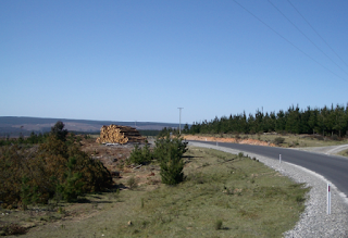
Just before entering the Blue Mountains National
Park Oberon-Colong
Stock Route which was now the only access road to
Yerranderie, since the construction of Warragamba Dam had cut off its access to Camden in the east.
We passed a trail bike rider emerging from a side track
shortly before reaching Mt Werong Picnic and Camping Area, where a brief stop
allowed us to re-check maps (even though I had a detailed one sitting on my
lap). We decided to detour along the narrow and rough Ruby Creek Track to see
if we could find the Ruby Creek Mine, despite a sign warning of a locked gate
ahead, and came to a parking area with a walking track.
Here we followed an undeveloped foot pad, marked regularly
by arrows on posts, which meandered through the forest. As we had no idea how
far we needed to walk before we would encounter the mine, we almost stopped
after about 1 km. But then we decided to push on and shortly afterwards came
across the remains of a mine below us next to the creek. The ruins of a
corrugated iron hut also stood at the end of a road, indicating to us that we could
have driven in here if we had proceeded a little further down the main road to
Yerranderie before turning off! However we would have missed the walk through
the forest. I enjoyed the return walk much more, taking in the forest,
recognising familiar landmarks and having some idea of where we were going.
Eventually we reached the Cruiser and then the road, only to
join a convoy of vehicles all unfortunately heading in our direction, resulting
in us eating dust as we progressed onwards along the rough track of the narrow
ridge. However we were still able to see the views of the blue mountains
plunging down to deep valleys when less dense patches of forest made this
possible.
Further on an area of tree ferns clinging to the
mountain-side under the shade of the forest provided added interest and a
delicate flowering creeper added regular splashes of purple to the forest floor
in a number of places. Then the vegetation changed again – to an under-storey of
bracken and an egg-yolk coloured flowering shrub beneath more scrubby looking
trees. The shrill chirping of cicadas was ever present as, what must be
thousands, joined in the chorus.
The vegetation constantly changed even though the cicada
chorus did not. We went up steep winding sections, down very steep winding
sections, crossed saddles and a few creeks, wound around the edges of mountains
and left the convoy far behind where it had stopped at a high level area of
rock platforms (which we will check out on our way back out).
After finally reaching Yerranderie and finding the Private
Town we faced some confusion about where to pay our entry fee, until the convoy
arrived and the Caretaker magically appeared, watched the convoy depart (as one
bossy lady informed them that they had taken the wrong road and should have
stopped and waited for directions at the top of the hill), and finally attended
to us.
Yerranderie Private Town
Then, armed with a clear conscience and a purchased booklet
about Yerranderie, we wandered around the old buildings and then along old mine
roads, exploring the surrounds of the Silver Peak Yerranderie Peak Camden proved prohibitive
and a miner’s strike. Yerranderie was made up of several settlements, of which Private Town
and Government Town Private Town
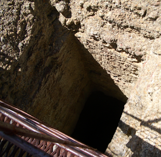
Silver Peak Mine
 |
| The safety catch on the Miner's Cage was invented here |
Colon Mine remains
Following this we ventured along the track past the cemetery
towards Tonalli River
We returned to Government
Town
This time we followed the notes in our 4WD Treks Close to Sydney
We then left this area to explore along another 4WD track further north.
Remember: Kind words can be short and easy to speak, but their echos are truly endless. Mother Teresa
 |
| Yerranderie Peak |


No comments:
Post a Comment