Showing posts with label Bushfires. Show all posts

Monday, 9 March 2020

Grieving losses: Flinders Chase National Park, Kangaroo Island, South Australia


I could not leave this series of posts without mentioning Kangaroo Island, which was extensively burnt in the Summer bush fires, as I watched in disbelief whilst more and more of the Island was impacted by fire. The cause of this, the Ravine Fire, was in beautiful Flinders Chase National Park, which we had visited in November 2004. This time the diary is taken from journalling in a scrapbook and the photos (taken with film: yes there was a time before digital!), had to be scanned from the scrapbook.


Something had been dropping on the roof of the van all night (Gumnuts? Pinenuts?), and we had heard Koalas fighting (they appear to change trees at night and must dispute trees). Apparently this in only one of two main places to find Koalas on K.I. (they are not everywhere at all!!). John had a breakfast companion with a kangaroo resting next to the van, and there was a Koala in a tree near the van. (We were stating at Western K.I. Caravan Park and Wildlife Reserve).


Today we drove into Flinders Chase National Park and visited Park headquarters first up for registration ($6.50) and maps. We then stopped briefly at Bunker Hill Lookout on the way to Admiral’s Arch at Cape de Couedic Lighthouse. We followed the long boardwalk and steps down to the Arch and New Zealand Fur Seals. Two seals were having an altercation on the rocks.


Everything has French names this end of the Island (Baudin must have gotten here before Flinders). We were back in limestone cliff country (hence the Arch), but here was an abundance of wildflowers (some unique to this Island). There were small islands off Cape de Couedic.


Weirs Cove (which we visited next) must have escaped Baudin’s attention and been named later! It is a short drive from the lighthouse and was the closest place to land lighthouse supplies (probably a long way for a horse). The flying fox was used to bring people and horses as well as goods up the cliff (and sandstone for the lighthouse). The Keepers lived in cottages at the lighthouse, but other workers lived at Weirs Cove and the ruins of the living quarters indicated that there was only one room per family.


Next stop was Remarkable Rocks (still on the tourist trail, with an impressive board walk out to the rocks). There were warnings not to venture too far from the ocean side (you could easily slide into the ocean). I  found out that it is a good idea to check how much film is left in the camera before leaving the car – I had to walk back to get some!


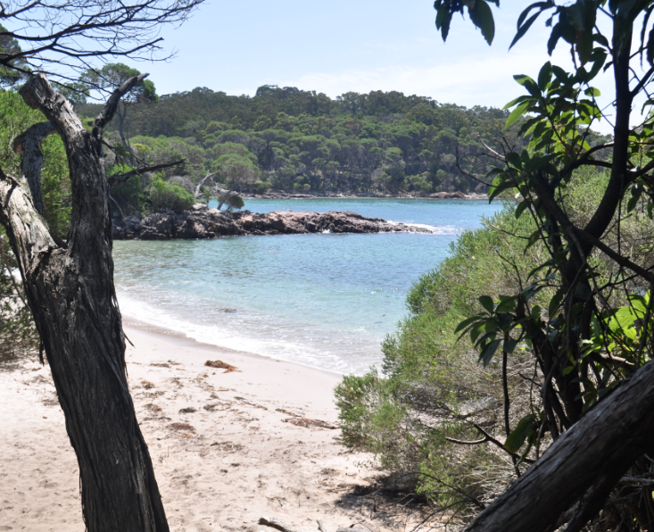
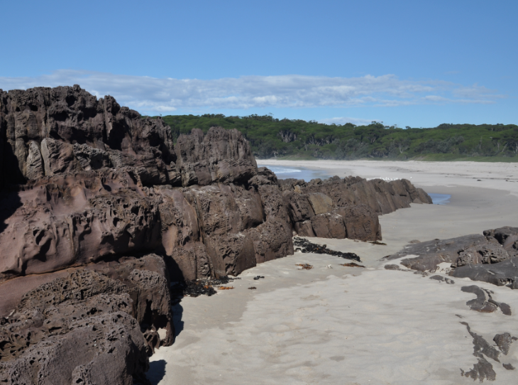
After this we travelled to West Bay Beach and, to get here we followed an unsealed road through various types of Park vegetation and past walking tracks to Rocky River and Breakneck River (both closed). West Bay Beach was a beautiful secluded beach (which we had to ourselves until we left). We 
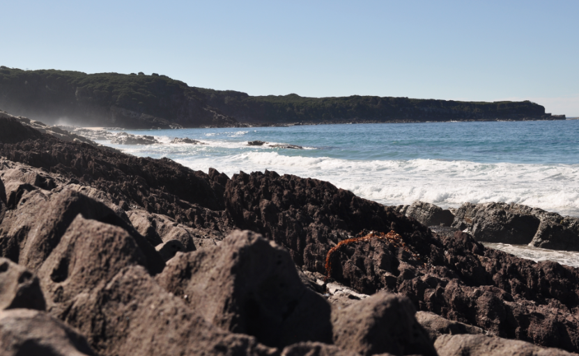
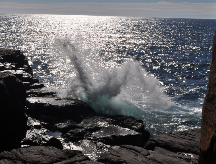
first followed a cliff walk across treacherous limestone, and then walked along the beach (our first beach walk this time!). The Loch Vennachar was wrecked off this beach but not found for 70 years. The only inhabitant ever here was a possum trapper, but there is also a grave of a shipwrecked sailor who walked this far from further around the coast. When we got back to the car an Osprey appeared and hovered over the beach (until another car arrived).


We had to travel nearly all the way back to the Visitor’s Centre before reaching the beginning of the very corrugated Shackles Road, which went north through the middle of the wilderness area. There were a number of marked spots with explanations in a booklet we had been given. We travelled through a range of vegetation and wildflowers until eventually joining the Playford Highway near Cape Borda. It was too late to do the lighthouse tour, which was at 2 p.m., so we decided to visit here tomorrow, although it meant a long drive back. We could see a kangaroo hopping backwards and forwards across the road in the distance, but when we reached it, “it” turned out to be two mating. 


Near the beginning of Shackles Road we had taken a detour into Platypus Waterholes (Platypus are introduced species), and a short track to the first observation point – here we saw plenty of bubbles and action, but none would surface. We also stopped at Bullocks Waterhole, where there were lots of wildflowers.


Remember: If you are depressed you are living in the past. If you are anxious you are living in the future. If you are at peace you are living in the present. Lao Tzu (Which is all we can ask in these challenging times).


Tuesday, 18 February 2020

Grieving losses: Fire in Ben Boyd National Park, Eden, NSW

One of the very large fires that occurred over Summer impacted on the southern section of Ben Boyd National Park and, to quote the NSW National Parks Service, this included: "all access roads, walking trails, lookout points, day use areas, campgrounds and visitor attractions", all of which are currently closed, but a few may re-open in March. We have visited this area twice -- once in 2016 and again in February 2019, and my diary is from May 2016. I believe that the Green Cape Lighthouse area may not have been burnt, but it is difficult to obtain information, and the access roads to it have definitely been swept by bush-fire.


After some showers of rain last night we woke to a cleansed but sunny world and drove down towards Green Cape to begin to explore the coast from there upwards.


Once we entered the southern section of Ben Boyd National Park, our first stop was a lookout over Disaster Bay with sweeping views beyond the state border. Further along we suddenly emerged from forest into open countryside, crowded with the remains of low coastal scrub which had been decimated by a less recent fire, but understoried by healthier coastal heath featuring bright red bell shaped flowers.


The Green Cape Lighthouse complex was now accessed via a 200 metre steel pathway with no access to any of the buildings, but taking us to a lookout on the end of a narrow point. As expected, the coast here was fractured and rugged and the views were extensive both up and down the coast, as this Cape juts out further than most.


Next we took the rougher road out to Pulpit Rock and had a wonderful time climbing down and across a large rock platform to explore the formations on either side – sheer cliffs backing Pulpit Rock (which was isolated by a deep channel and provided a safeish resting place for seabirds) on one side and another straight sided narrow promontory of rock on the other – and waves crashing against the platform and sending up huge blowhole- like plumes of white spray. Back at the car park we startled a Goanna and it quickly scrambled up a tree and then, as we drove to the turn-off to City Rock, we almost side-swiped a large grey kangaroo.


City Rock proved to be a fairly uninteresting jumble of squarish boulders on a rock platform on the edge of Disaster Bay, but the 4WD track in was enjoyable and the 500 metre return track was interesting, taking us through burnt scrub understoried by lush new growth and enlivened by the encountering of a black snake in a wet area at a footbridge.


After returning to the main road, another side track took us out to Bittangabee Bay – a pretty little cove with a natural harbour (complete with a catamaran and the intriguing remains of a building on one side, which turned out to be the lighthouse store ruins). A short walking track took us down onto the little beach and we could have taken another track out to the headland at the back of the camping area, but we chose to continue on to Saltwater Creek.


We lunched at Saltwater Creek before exploring its lovely beach backed by a murky coloured lagoon, climbed up purple bands of rock lying parallel to the beach, and wandered a little ways north along the Light to Light Coastal Track, as we could see another beach to the north of us (which we did not reach) and had better views of the lagoon.


Coming out of here, we took the rougher Duck Hole Road and then veered off it onto a 4WD track (Saltwater Creek Road) that took us over a small rotting bridge (complete with danger tape), skirting around fallen vegetation, straddling eroded gutters, disturbing a Lyre Bird, through narrow closed in sections where we were bush-kissed, down into gullies and back up again, to finally re-join the tarred Edom Road and zoom up to Boyd’s Tower.


The sight of Boyd’s Tower in the bush was still impressive (we had been here in 2001), but I was more impressed by the ancient coastline which featured a huge circular anticlinal fold and the red siltstone rocks typical of this area (apparently formed from volcanic ash).


With a bit of guess work and luck we managed to locate the 4WD track to Leatherjacket Bay (once again unmarked at the beginning but signposted with an impressive wooden National Parks sign once we had travelled a little way along it). The Bay was a small boulder strewn inlet backed by sand and featuring another large anticlinal fold, and we found that we could continue 4WDing out to Mowarry Point, a little further inland from the Light to Light walking track.


The 4WD track ended near a pretty little beach below Mowarry Point and we had to walk the final 500 metres onto the Point, where we found that views were hampered by dense vegetation – so we bush-bashed our way down onto the beach via a dry water-course and later found the official walking track at the back of a grassy camp site. Then it was 5 km of slow 4WD back-tracking out to Edom Road to drive south again to join the Princes Highway and zoom back to Eden.


Remember: Never regret being a good person to the wrong people. your behaviour says everything about you, and their behaviour says enough about them. Marc and Angel