We drove south down the New England Highway to Deepwater,
where we turned to Torrington and travelled on a single-laned rough tarred road
with rough edges. This took us through dry grazing land and across dry creeks
(although there had been water in Deepwater River), before winding us through
hills to Stannum (a collection of a few dwellings), across to forested ranges,
and on to Torrington (a ramshackle collection of buildings).
Here a sign pointed to “Mystery Face” (the only indication
of the way to Torrington State Conservation Area), but after we passed a sign
to Thunderbolt’s lookout (hidden in the bush) and consulted our map, we
returned to Torrington and found a clearer sign, and then followed a track to
Nomad’s Picnic Area and the other end of the walking track to Thunderbolt’s
Lookout.
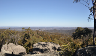
This 1.6 km return well-formed track took us through fields
of massive boulders and then steadily upwards to an impressive outcrop of
granite, which we then navigated through via natural tunnels (stone steps had
been constructed where needed), to reach a steel ladder, which we climbed up to
a steel-sided lookout on top of the outcrop. From here we had extensive views
over the ranges beneath us, out towards Inverell and down over Torrington – an
interesting and exhilarating walk.
Returning to Torrington, we once again turned onto the road
to Mystery Face and this time, further up the road, found a clearer sign into
the Conservation Area. Tin mining used to occur in this whole area and signs
warned us not to venture off roads and tracks, and the road to Mystery Face
took us past small-holdings squirrelled away in the bush.
The 2.6 km Mystery Face Walk was one of the best that we
have done in granite country, taking us past (and over) a number of granite
outcrops, all of which had interesting formations, and some of which had clefts
to walk through and/or explore. Some formations were named: Mystery Face (of course),
The Brain (near Mystery Face), Westminster Rocks (where many clefts and
cavities could be explored) and Boarhead (but only recognisable if viewed from
a particular angle).
We had a late lunch back at the car park, sitting at a
picnic table overlooking a small perched swamp, and then drove back out to the
road up to Blatheram Camping Area. A side track took us to a small parking area
for the less well marked walking track to Ugly Corner Falls (2.6 km return).
This track took us steadily downwards on an old fire-trail, past a picnic
table, and then onto a narrow footpad that descended more steeply into the
gorge formed by the creek, downstream from the Falls.
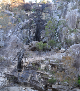
We then edged the creek (where only a few pools of water lay
in the smooth granite slabs of its bed), before crossing the bed of the creek
and toiling up eroded steps on the other side to a natural rock platform
lookout across from the face of the dry, but high and impressive, two-tier
waterfall.
After puffing back
uphill via the way we had come, we drove to the first camping area and
discovered that these had been placed here for fossicking in the nearby small
creek (which was currently dry).
Then we took the gravel Silent Grove Road north, following
an impressive wall of fractured granite and passing through more outcrops, and
then along a range (difficult to discern due to the dense forests), through a
forested valley and over another range to reach Mole River Road, and then,
finally, the Bruxner Highway.


No comments:
Post a Comment