Monday, 3 February 2020

Grieving for losses: Fire in Crowdy Bay National Park: Part 2

It was cold when we awoke, but to a blue sky with almost no clouds. The necessary task of washing was accomplished before we set forth to return to Crowdy Bay National Park to walk the 4.8 km Diamond Head Loop Walk (which we have done previously on another trip).


This walk was just as enjoyable the second time around, although we did it in reverse this time. First we climbed upwards to a track junction where the loop joined (and did this without puffing, so we must be becoming fitter), and elected to cross to Indian Head Camping Area via the forest first. This took us through a variety of vegetation – stunted coastal woodland where Banksias reigned and patches of rainforest in sheltered gullies where we crossed tiny running streams (once by rock hopping).


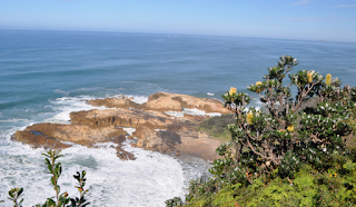
After reaching Indian Head Campground the track took us briefly through more rainforest before emerging at a lookout point with spectacular views back up to Crowdy Head. Then it hugged the cliff line (but not at the very edge) and took us to side tracks to views over The Arch and a grass topped almost island far below us. Along the way we met a couple from South Australia whom we had seen yesterday at Crowdy Head searching for Fish and Chips for lunch. They had now berthed their A-Van at Diamond Head Camping Area and said that condensation had dropped on them last night and the firewood was too damp to burn.


We left them to their bird observing (and we had noticed a number of varieties as we walked) and, after more spectacular wild coastal views from cliff tops, crossed through a gully and ascended from Indian Head onto Diamond Head and here took in the macro views both over the coast and inland to The Brothers. An information board next to the track gave us a slightly different version of The Brothers creation story in that only two of the brothers were killed by the witch and the third brother killed the witch. We reached a trig point, after which we began to descend, initially with views over both Crowdy/ Kylies and Dunbogan Beaches, and later we passed by large patches of Trigger Ferns amongst the coastal scrub.


As we walked this track, I reflected that it was really good to spend some time on one headland to break our pattern of dashing into and out of beaches and onto lookout points on headlands.


Remember: You can accomplish by kindness what you cannot by force. Publilius Syrus


Sunday, 2 February 2020

Grieving for losses: Fire in Crowdy Bay National Park, NSW North Coast

This fire occurred early in the season, in October last year, but today a small fire is burning again. We visited this National Park for the second time in the winter of 2011, and would be happy to return in the future once it re-opens. The camping areas were beautiful and the walking tracks spectacular.


We drove around to Crowdy Head, where we found a fishing fleet and a small lighthouse, situated on a headland with breathtaking views in every direction. We ate our lunch here with John spotting for whales (unsuccessfully) over the turquoise blue sea and me admiring the view over Crowdy Bay where the sun turned the sea silver and the mountains backed the long beach bordering the national park.


Now we returned to drive back up through Crowdy Bay National Park, but this time taking side tracks to points of interest, the first of which was Crowdy Gap. Here we took a 340 metre walk to the beach. For the shortness of its length, this track left many impressions – the intensity and variety of the bird calls in the forest, the bridge over the bog where the dark water would have come up to our calves, the fallen many branched Banksia over the track (making for interesting navigation) and emerging onto the beach to look directly across to the houses of Crowdy Point.


Our next detour was to Abbey Creek Picnic Area and here an unofficial goat track took us the short distance to Crowdy Beach (a little further around than where we had just been) but no creek could be found, even by scanning up and down the sand on the beach with our eyes.


We now travelled back to the northern section of this national park and, after turning in towards Kylies Beach, we travelled south to Fig Tree Parking Area. And a short walking track took us through a forest and across low vegetated dunes to what was now called Kylies Beach. But the 4WDer that cruised past us here and those we could see beach fishing further north, could all drive seamlessly from here down Crowdy Beach!


Whilst back-tracking up to our turn off point, we decided to bypass Mermaid Parking Area (as it was just another access to Kylies Beach) and proceed up to Kylies Beach Camping Area and Car Park instead. Here there were a number of campers and we followed the 4WD beach access track (by foot) onto the northern end of Kylies Beach, where the dark tannin coloured waters of a creek flowed rippling across the sand to merge with the waves that were crashing over jagged rocks.


After driving to Indian Head Campground we walked in to view Kylies Hut – previously built for the writer Kylie Tennant who loved to come to this area when she lived in Laurieton. The hut was in a lovely quiet, secluded and sheltered area, so it was not surprising that it was appreciated by Kylie. After this we returned to Laurieton, where we were based in our caravan.


Remember: Keep being kind. Keep trying. Keep listening. Keep loving. Because sometimes the smallest of ripples, together can make a wave. Gratitude App


Saturday, 1 February 2020

Grieving for losses: Postman's Track, Bega Valley, NSW

There is an out of control rapidly moving fire along the Postman's Track today, and it has already burnt more than 1,000 hectares. We drove this 4WD trail in 2016, but I imagine it will be closed for quite some time now. Sadly, areas that escaped earlier in Summer are now being consumed by bush fires.


It was cold last night and this morning in Bombala, and wood fires had cast a smoke haze and smoky aroma across the landscape. We drove out to Cathcart on the Mt Darragh Road and found Cathcart to be a small settlement with a hall and general store, and a mixture of old and newer houses, glimpsed as we continued across the plains to take the gravel Tantawanglo Mountain Road out towards another section of the South East Forests National Park, crossing grazing land and driving through forests on the way.


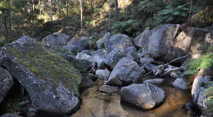
Initially we drove down to Six Mile Creek Rest Area, to explore this area of dense forest clinging to the sides of ranges. Here we took the 300 metre boardwalk along the lovely unspoiled Tantawanglo Creek, which flowed in a transparent stream over a sandy bed and around granite boulders, forming small white cascades, to reach a medium sized waterfall which tumbled down a steeper granite slope. We then found well-formed steps leading from the viewing platform to the creek bed, and brushed through the slightly overgrown sections to reach a section of large boulders. By rock-hopping a little way upstream we had another perspective of the falls (although here I found a juice box eddying around and around at the base of a small cascade).


Before leaving, we surveyed the small camp ground (that did have one taker in a camper trailer), and I found a small sandy bend in the creek.


We returned up Tantawanglo Mountain Road to follow the 4WD Postmans Track through a tall forest, featuring Tree Ferns and Bracken, downwards to reach Postmans Camp on a sandy bend of the Tantawanglo Creek. Here we did find the remains of the foundations of a hut (after a bit of searching), and we needed to cross the creek at sandy Devils Crossing (and nearly lost a mudflap in the process). The Postman used this track in the second half of the 1800s to transport mail by horse and packsaddle from Cathcart to the bottom of the escarpment at Kameruka, where others then took it to the coast.


Shortly after Devils Crossing, we descended steeply to cross the creek again, and then we continued to climb steadily, and then more steeply, up again to reach a more level section of the Postmans Track. This took us to join the Cattlemens Track – another 4 WD track with some steep climbs and descents. We stopped for morning tea at a bridge crossing over an unnamed creek (probably Tantawanglo).


Continuing on, there were a couple more steep climbs and descents, one over another creek crossing, but eventually we reached the top of the escarpment and relatively level ground. Then, seemingly a long way from the end of the Cattlemens Track, we encountered a couple walking, who enquired how far it was to Postmans Camp – we told them “about 15 kms with lots of ups and downs” and, after recovering from their surprise, they replied that they would keep walking until it got too steep (we forgot to tell them about the water crossings). Finally we joined the better formed Robinsons Track .


Remember: If you wait until everything is your life is perfect befroe you begin something challenging and new, you'll  be wating forever. The best time is now. Bill Phillips